BOOK & BUY PERSONALISED FORECASTS:
Our forecasters will write a forecast specifically for you, and email it to you.
Simply book in advance and we'll email the forecast to you at the time you specify.
You'll also be able to telephone the forecaster to discuss the forecast.
Forecasts can be made for anywhere in the world, and cost just £17 (inc VAT).
To book your forecast, and to see a sample, go to http://www.weatherweb.net/buy.htm
************************************************************************
Hello again,
As the summer draws to a close this weekend isn’t looking too bad, especially compared to what has gone before. Most of the UK has had double the usual rainfall, half the sunshine and cooler temperatures than usually expected in August, no wonder summer 2008 won’t go down as one of the best!
You can watch the forecast for the weekend, 5-day outlook and learn more about the weather at Europe’s first WebTV weather channel, Weatherweb.TV now! Forecasts at Weatherweb.TV are updated every day.
If you have a friend who wants to receive this forecast each week they just need to send an email to sailingweather-subscribe@weatherweb.net
Best wishes,
Simon
WEEKEND WEATHER FORECAST
Issued: 1100 Thursday 28th August 2008
SATURDAY:
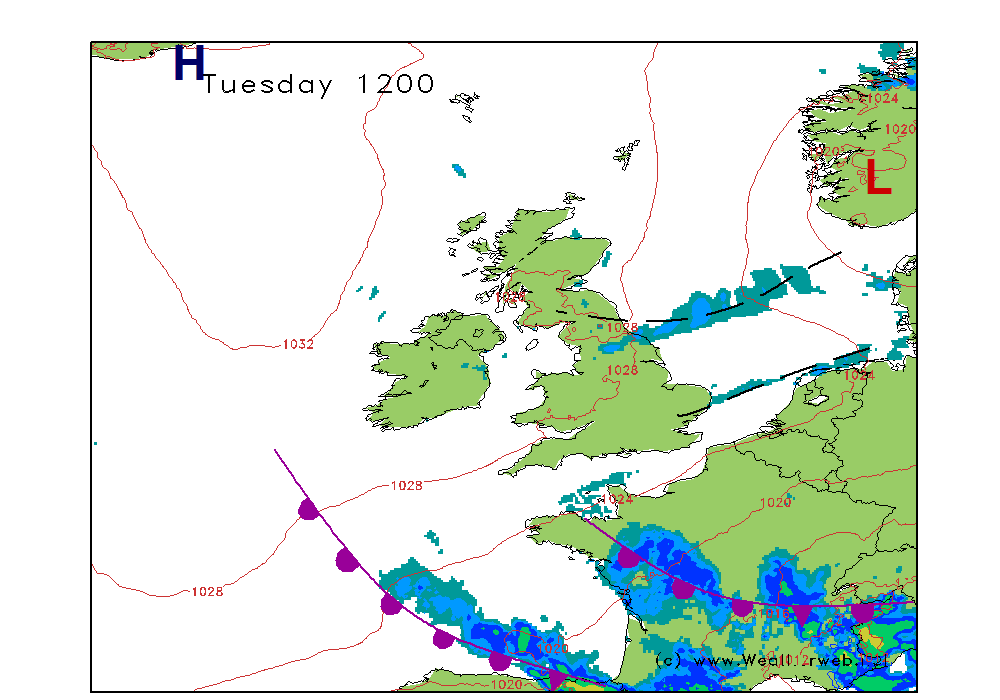
High pressure to the east of Europe with low pressure to the west and the UK is in the resulting S to SE flow between these two areas. This will bring a none-to-bad-a- day to most of the UK and Ireland, although we do need to keep a careful eye on low pressure in the bay of Biscay and the fronts west of Ireland as these could trigger some thundery rain or showers in the west late on in the day and overnight into Sunday.
Generally though it is going to be a fine day for most of the country. Good spells of sunshine and feeling very warm too. There could be a few fog patches drifting along eastern coasts, and also some more over the south and east coasts of Ireland and the west coast of Wales.
Dry for most of the country but the threat of those thundery showers breaking out in the west and southwest towards the afternoon and evening.
Winds will be mainly S-SE 8-12kt (F3-F4) with sea breezes enhancing these speeds on the coasts. It may become quite gusty inland too.
SUNDAY:
The fronts have edged a little further eastwards through the course of Sunday pushing thundery rain and showers into the mainland of the UK. As these edge further east in the afternoon they will destabilise the atmosphere encouraging thundery showers to become more widespread. At the same time a ridge of high pressure builds through Ireland, western Scotland, Wales and western England causing any showers to fade away and fair weather to return here.
Eastern parts of the country may start the day fine with sunny spells, but again some fog may trouble the eastern coasts. Into the afternoon the thundery showers will be developing through these central and eastern areas, the focus for them at the moment to the north.
To the west the morning starts grey and thundery, although into the afternoon things will improve, the sun will come out and it should be a dry end to the day.
Winds will be S-SE 5-10kt (F3) ahead of the front, then becoming W-WNW 5-10kt (F3) behind it.
Do note that the confidence in the detail of this forecast is low.
**ends**

 [/img]
