BOOK & BUY PERSONALISED FORECASTS:
Our forecasters will write a forecast specifically for you, and email it to you.
Simply book in advance and we'll email the forecast to you at the time you specify.
You'll also be able to telephone the forecaster to discuss the forecast.
Forecasts can be made for anywhere in the world, and cost just £17 (inc VAT).
To book your forecast, and to see a sample, go to http://www.weatherweb.net/buy.htm
************************************************************************
Hello again,
Let’s hope this week’s forecast is a little more accurate than last weeks!
If you want to receive this forecast by email each week, just send a message to sailingweather-subscribe@weatherweb.net
Best wishes,
Simon
WEEKEND WEATHER FORECAST
Issued: 1100 Thursday 5th June 2008
FRIDAY:
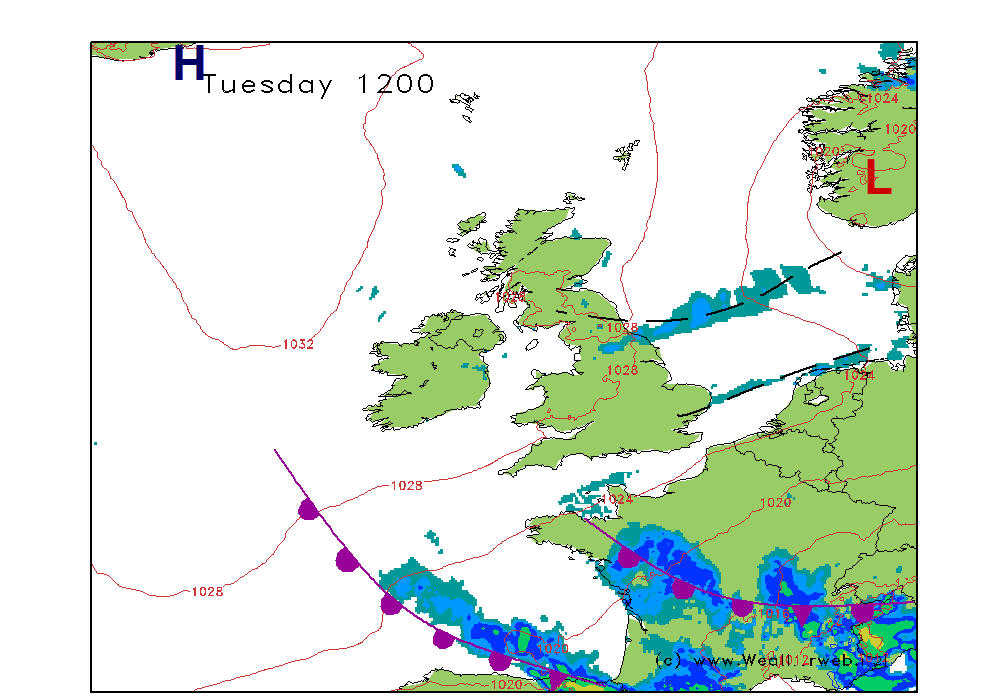
High pressure is expected to be south of Ireland, extending a ridge notheastwards through Ireland and into the west of Wales. Low pressure over northern Europe brings a more north to northeast flow through much of the rest of the country with weak occluded fronts moving east.
For eastern coasts of Scotland and England the day looks set to be rather wet and cloudy. Most of the rain light, but a few heavier bursts are possible too.
Further west the cloud is going to be more broken and it is here where there will be some bright or sunny spells. However, showers are going to be developing and some of these are expected to become heavy at times in the afternoon.
Winds will be mainly W-NW 12-15kt (F3-F4) in the west, but N 8-14kt (F3-F4) in the east.
SATURDAY:
The occluded front lingers down the eastern coasts on Saturday, although I think it is likely to be weakening significantly. A ridge of high pressure maintained over Ireland and Wales, as well as southwest England, with more organised fronts moving into western Ireland later.
The cloud and outbreaks of rain associated with the occlusion in the east should be fading away, although there could be more persistent for a time over central and eastern Scotland. It should become dry in the afternoon for most, the cloud slowly breaking, but with the flow off the North Sea I can’t rule out the risk of some low cloud.
Further west conditions are brighter and drier. Some good spells of sunshine over Wales, southwest England and western Scotland. Some showers could affect Ireland and then more persistent rain reaches western Ireland later.
Winds will be mainly W-WNW 5-10kt (F2-F3) over Wales and much of England. More variable in Scotland at 5-10kt (F2-F3) and then turning more S’ly 10-15kt (F4occ F5) over western Ireland later as the fronts approach.
SUNDAY:
There are some disagreements between the forecast models for Sunday, based around how quickly the frontal systems travel eastwards.
It does look like being a bright and dry start o the day for much of central and eastern England. There will be some good sunny spells around for most.
Thicker cloud and outbreaks of rain in Ireland will be moving eastwards. These will tend to become more persistent as the afternoon wears on.
Most of eastern England and Scotland should stay dry.
Brighter weather will be following to Ireland in the afternoon, with sunny spells here.
Winds will be mainly SW 10-12kt (F3-F4) ahead of the rain, then W 12-15kt (F4 occ F5) as it passes through.
**ends**


