

Weather
-
claymore

- Admiral of the Green
- Posts: 4763
- Joined: Sun Oct 19, 2003 2:55 pm
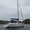
- Boat Type: Claymore
- Location: Ardfern or Lancashire
Re: Weather
XC is suggesting a rather fresh Northerly airstream prevailing Thursday through Friday which may compromise the ambitions of those intending to sail UP to Oban.
Chilly too.
Oh Joy.
Chilly too.
Oh Joy.
Regards
Claymore

Claymore
-
aquaplane

- Admiral of the White Rose
- Posts: 1555
- Joined: Thu May 17, 2007 12:55 pm
- Boat Type: Jeanneau Espace
- Location: Body: West Yorks; Boat: Tayvallich
Re: Weather
How fresh is fresh? If it's a "lets stay put" fresh we won't be going far.
We have an ingin, and know how to use it if it's now bonkers to do so.
The thing about meeting folk who are going to be at point X is, you have to try to get to point X, or not meet.
I'd prefer point X to be at Craobh than at Dunstaffnage in this case.
We have an ingin, and know how to use it if it's now bonkers to do so.
The thing about meeting folk who are going to be at point X is, you have to try to get to point X, or not meet.
I'd prefer point X to be at Craobh than at Dunstaffnage in this case.
Seminole.
Cheers Bob.
Cheers Bob.
-
claymore
- Admiral of the Green
- Posts: 4763
- Joined: Sun Oct 19, 2003 2:55 pm
- Boat Type: Claymore
- Location: Ardfern or Lancashire
Re: Weather
Its probably too soon to call although I feel we can look forward to a drop in temperatures and a tad mair precipitation than we are used to at the moment...
Regards
Claymore
Claymore
-
wully
- Yellow Admiral
- Posts: 1589
- Joined: Tue Sep 22, 2009 6:29 pm
- Boat Type: Wingfoil- badly
- Location: Argyll - where else?
Re: Weather
Someone seems to have raised the tone of the Leirigoligan moorings....
-
Telo
- Admiral of the Red
- Posts: 2505
- Joined: Wed Jan 05, 2005 9:27 pm
- Boat Type: Vancouver 34 Pilot
- Location: Bampotterie-sur-mer
- Contact:
Re: Weather
The 48 hour forecast issued today from 1200 isn't great;
Extended outlook not any better;
Mull of Kintyre to Ardnamurchan Point - Strong winds are forecast
24 hour forecast: North veering northeast 4 or 5, occasionally 6 at first, becoming variable 3 or 4 later. Slight or moderate, becoming slight. Mainly fair. Good.
Outlook for the following 24 hours: Variable 3 or 4 becoming east or southeast 5, increasing 6 to gale 8 later. Slight becoming moderate, then occasionally rough later near Islay and Tiree. Fair. Good.
Extended outlook not any better;
Portpatrick
High pressure across the north of the Portpatrick area on Friday evening will transfer slowly east during Saturday. A cyclonic flow will then become established across all parts by midnight Sunday, with low pressure centred to the west of Shannon on Friday evening moving northeast through the period, to be over the north of the forecast area by Monday evening. A ridge of high pressure is also currently expected to extend north through western parts of the UK by the same time, however there are currently uncertainties regarding the synoptic evolution by early next week. Near gale to gale force winds in south Rockall on Friday evening will become extensive across much of the area to the north by midday Sunday. During Sunday, gales or severe gales are likely to persist in the north with further gales spreading east across southern parts. Current expectations by Monday evening are for gales to become confined to Rockall, Hebrides, Bailey, and Southeast Iceland.
-
aquaplane
- Admiral of the White Rose
- Posts: 1555
- Joined: Thu May 17, 2007 12:55 pm
- Boat Type: Jeanneau Espace
- Location: Body: West Yorks; Boat: Tayvallich
Re: Weather
We could end up stuck in Oban for a week, or at least the W/E which wouldn't be too bad I suppose.
The southerlies all next week don't make me want to head North but I suppose we will have to go to windward at some point.
The southerlies all next week don't make me want to head North but I suppose we will have to go to windward at some point.
Seminole.
Cheers Bob.
Cheers Bob.
-
Silkie

- Admiral of the Fleet
- Posts: 3475
- Joined: Sat Mar 05, 2005 12:55 pm
- Boat Type: Hurley 22
- Location: Bonnie Scotland
- Contact:
Re: Weather
The inshore waters forecast issued by the Met Office, on behalf of the Maritime and Coastguard Agency
For coastal areas up to 12 miles offshore from Friday 1 May 2015 at 0000 UTC until Saturday 2 May 2015 at 0000 UTC
General situation at 0001 UTC on Friday 1 May 2015
A ridge of high pressure across the United Kingdom will gradually give way to Atlantic fronts pushing in from the southwest later on Friday and through Saturday. The far northeast should however remain fair.
Mull of Kintyre to Ardnamurchan Point - Strong winds are forecast
24 hour forecast: Northeast 4 or 5, decreasing 3 at times, then veering east 5 or 6 later. Slight, occasionally moderate in west, becoming smooth for a time in shelter. Fair. Good.
Outlook for the following 24 hours: East veering southeast 5 or 6, increasing 7 or gale 8 later. Slight or moderate, becoming moderate or rough. Fair then occasional rain. Good, occasionally moderate later.
different colours made of tears