

We couldn't have picked easier conditions, no wind at all, though it was a bit misty.
Some figures.
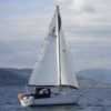
Mistral is a 1970's era yacht, 27' LOA, 23' LWL, 2.3t design weight, but with a modern 13.5hp engine.
16/07/2013 HW Campbeltown 05.49 BST.
We left the pontoon at Campbeltown at 04.00 BST, and built up revs as the engine warmed going out of the loch to settle at 2,500 rpm and 4.8 Knts through the water.
We seemed to have tidal assistance once we were clear of Island Davaar.
We were off Arranman Barrows buoy at 05.45 BST
We were off the red buoy in Sanda Sound at 06.15 BST and had 7.9 Knts SoG.
We were close in right under the lighthouse at 07.15 BST but only had 3.7 Knts SoG despite the log showing 5.1 Knts through the water. SoG went as low as 3.5 Knts before picking up again.
By the time we were 2 nmiles north of the lighthouse, SoG was up to 6.4 Knts.
Kept a bit of tide, maybe 1 Knt, all the way to off Tayinloan, and were on a mooring in Ardminish Bay by 11.30 BST.
The handheld GPS recorded a trip of 43.5 nmiles and a max speed of 9.5 Knts but some of that might have been me moving it quickly.
I recorded my track on OpenCPN but made the mistake of touching the netbook just at the crucial point, and had to restart the recording. The track recording shows maximum speeds just over 9 Knts, but just at either side of the break in recording so that might just be the GPS signal being re-established.
We slapped off one wave which I hadn't noticed early on before we got to Deas Point, but otherwise it was OK though we could see white water further offshore at Deas Point and under the lighthouse.
Maybe it isn't Deas Point – the last corner before the lighthouse – the one with the rocks sticking out into the water.
This surprised me a bit – any thoughts?We were close in right under the lighthouse at 07.15 BST but only had 3.7 Knts SoG despite the log showing 5.1 Knts through the water. SoG went as low as 3.5 Knts before picking up again.
Ash


