BOOK AHEAD FORECASTS:
Our forecasters will write a forecast specifically for you, and email it to you.
Simply book in advance and we'll email the forecast to you at the time you specify.
You'll also be able to telephone the forecaster to discuss the forecast.
Forecasts can be made for anywhere in the world, and cost just £17 (inc VAT).
To book your forecast go to http://www.weatherweb.net/" onclick="window.open(this.href);return false; buy.htm
************************************************************************
Hello again,
Easter Weekend is upon us so I have added an extra day to the forecast.
Weatherweb.net has been updated and now carries many more forecasts. I am working on adding more too. There are now:
• Surface frontal charts to 5 days ahead
• Detailed wind forecast charts for regions of the UK to 5 days ahead
• 5 day forecast texts for the UK, Ireland, France, Mediterranean and Europe
• Satellite cloud forecasts for Europe
• Month Ahead and Seasonal forecasts
So if you haven’t visited lately see http://www.weatherweb.net/uksail.htm" onclick="window.open(this.href);return false;
Onto the weekend forecast, and if you know anyone who’d like to receive this email each week just tell them to send a request to join to sailingweather-subscribe@weatherweb.net
Best wishes,
Simon
WEEKEND WEATHER FORECAST
Issued: 1200 Thursday 9th April 2009
SATURDAY:
Low pressure is going to be centred to the northwest of Scotland through Saturday. A cold front clears out of eastern England, but takes its time and there is a threat a break away trough returning to southeast England and East Anglia in the later afternoon and evening, bringing the threat of rain returning here.
Generally the morning is going to be a dry one with some good spells of sunshine. The best of the sunshine will be to the west of the country with Wales and western England doing particularly well in the sunshine stakes. A few showers may form over western Scotland and Ireland, with an odd one over Wales.
The afternoon sees that rain creeping into the southeast of England and East Anglia, most of it light but perhaps turning moderate for a short time. Still a few showers over the mountains of Wales, parts of western Scotland and Ireland. Elsewhere it should be a fair afternoon with good spells of sunshine.
Winds will be Mainly S-SW 5-10kt (F2-F3) in the south, perhaps with some sea breezes forming here and there, and SW 20-25kt (F5-F6) for northwest Scotland.

SUNDAY:
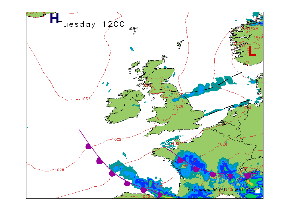
A slack pressure flow across the country for Sunday and this is giving some confusing signals as far as conditions are concerned. The trough marked on the chart is really to illustrate an area of instability which could produce some showers. The main feature to watch is the area of low pressure developing off southwest Ireland as that could bring increased winds and the threat of some more unsettled conditions for Monday.
For Sunday morning it should be fine but chilly start to the day for most of the country. There will be plenty of sunshine on offer and it should be dry too. The trough to the northwest is going to trigger some showers fairly quickly over north Wales, northwest England and western Scotland, but elsewhere it should be dry.
For the afternoon it will be northern England and Scotland that again see the highest risk of showers. Other places should be staying dry with more sunshine to come. Cloud is going to be increasing through southern Ireland and southwest England making the sunshine hazy and bringing rain and stronger winds to southwest Ireland by evening.
Winds will be generally W-SW 5-8kt (F2-F3) for most, although some sea breezes could form over the south and east. The winds increasing through the afternoon across Ireland and southwest England becoming S-SE 20-25kt (F5-F6) here by the evening.

MONDAY:
Low pressure is southwest of Ireland through Monday with an occluded front pushing north. Pressure tending to build through northern Scotland, although the low to the east is going to try to push some cloud and outbreaks of rain onto eastern coasts of Scotland and England.
Generally for the south of Ireland, Wales and England it is likely to be a cloud, rather wet day. Confidence in the positioning of the rain is low at the present time, so keep your eye on the forecasts through the weekend.
More northern areas should be drier, with the best of any sunshine in western Scotland. Eastern Scotland and northeast England may be troubled by the cloud and outbreaks of rain emanating from the low in the North Sea.
Winds will be mainly E-SE 18-24kt (F5-F6) over southern Ireland, southwest Wales and southwest England, nearer E 12-15 (F4) elsewhere.

***ends***

