BOOK AHEAD FORECASTS:
Our forecasters will write a forecast specifically for you, and email it to you.
Simply book in advance and we'll email the forecast to you at the time you specify.
You'll also be able to telephone the forecaster to discuss the forecast.
Forecasts can be made for anywhere in the world, and cost just £17 (inc VAT).
To book your forecast go to http://www.weatherweb.net/index_files/buy.htm" onclick="window.open(this.href);return false;
************************************************************************
Hello again,
Another weekend is here and isn’t it good to see the days getting longer as each week passes?
For this weekend Sunday looks to be the best day as high pressure builds in and dominates conditions. More details below.
The Weekend Forecast is at http://www.Weatherweb.TV" onclick="window.open(this.href);return false; with all the latest information is available for you to view via that service.
Onto the weekend forecast, and if you know anyone who’d like to receive this email each week just tell them to send a request to join to sailingweather-subscribe@weatherweb.net
Best wishes,
Simon
WEEKEND WEATHER FORECAST
Issued: 1000 Thursday 12th March 2009
SATURDAY:
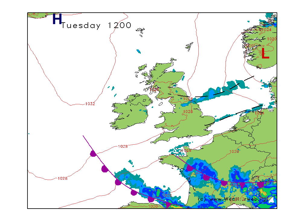
Low pressure is going to be to the northwest of Scotland at midday on Saturday, with a slowly moving trough edging eastwards through the country. A ridge of high pressure builds through Ireland and the west of Scotland in the afternoon.
So it is likely to become increasingly cloud and damp through the morning with heavy periods of rain crossing Scotland, northern England and the Midlands.
Lighter rain to the south, although there could be some moderate bursts at times. This rain only slowly pushing eastwards, although as it does so drier weather should follow to Ireland and western Scotland in the morning, this drier weather into the west of Wales, northwest England and southwest England in the afternoon. Only a slow improvement through central and eastern parts of the country.
Winds will be SW 20-25 (F5-F6) ahead of the trough, gusts to 30kt (F7) as the trough passes overhead. Becoming NW 18-23kt (F5) behind the trough and then NW 14-18kt (F4-F5) over Ireland in the ridge of high pressure later.
SUNDAY:
High pressure is going to continue to build through the night, and it will do so quite rapidly with the centre of the high being off southwest England, and drifting slowly eastwards. A cold front is likely to move into the north and west of Scotland with increased winds here too.
A fine morning over much of England, Wales, southern Ireland and the south of Scotland. It is going to be staying dry here with some good spells of sunshine, although there could be some morning mist and fog patches at first inland. Little change into the afternoon with conditions staying largely fair, although I suspect that there is likely to be a fair amount of cloud around throughout. A low risk of some low cloud, mist and fog patches affecting southern coasts of Ireland, Wales and southwest England. Also the chance of some residual rain into the early morning across the far southeast.
For the north and west of Scotland the cold front will bring some showery periods of rain through the afternoon, a few of these heavy on the hills. Windier here too with gales in the north.
Winds will be mainly W 6-10kt (F2-F3) in the south, perhaps NW over East Anglia and SE England. Becoming WSW-SW 8-2kt (F3-F4) through northern
England and Ireland, and SW 20-30kt (F6-F7) over
NW Scotland but SW 12-15kt (F4-F5) in southern
Scotland.
***ends***


