


Found our way into Millport Bay on Thursday only to find all the buoys occupied. Threw the Knox over the bow with 30 odd metres of chain and settled down. The wind came up and we amused ourselves watching other boats that came in later dragging and hoiking up large clumps of kelp. Around 2am the GPS alarm (set to 0.02nm) went off and, yes, the lights on the shore were moving. The wind had been gusting up around 30kts for a while, those mast and boat shaking blasts and, I have to admit, I hadn't gone through the CQR careful setting procedure when I lobbed the Knox over but it was the 1st time that the Prof's creation had ever let me down. When I heaved it up (actually pressed the up button on the winch) there was a massive clump of kelp complete with roots, stones and a fair amount of seabed. Reanchoring worked, lights on the shore didn't move and anyway, the wind dropped a bit.
My memory is that bay used to be clean with the bottom usually visible. Has the stonework changed the flow and encouraged kelp? Or was I just too complacent with my anchoring technique? It couldn't possibly be my choice of anchor, could it?
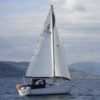
Millport Bay
-
ash
- Yellow Admiral
- Posts: 1713
- Joined: Tue Mar 01, 2005 12:14 pm
- Boat Type: Moody 346
- Location: Tarbert, East Loch Tarbert, Loch Fyne, Scotland
Re: Millport Bay
I don't know if that bay was ever clean, I've never anchored in it. I've watched a few boats lift anchor, and they've all brought up weed.
Someone with a fish finder type sounder told me that as well as weed, much of the bottom is a thin layer over rock.
I use Kames Bay ( East bay ) to anchor when there are no moorings available. It has good holding in clean sand. No breakwater, so would not use it when the wind is from the south.
The moorings are very busy, so boats sit at anchor till one becomes free and nip on to it
PS we were anchored in Kames Bay on Thursday night, CQR on 35 m of chain. According to my anchor watch app, we might have moved about 10m during the night but my position for the anchor was only calculated after we had settled.
Ash
"This is a sailing Forum"
Albin Vega "Mistral" is now sold
Albin Vega "Mistral" is now sold
-
Nick

- Admiral of the Blue
- Posts: 5933
- Joined: Sun May 12, 2002 4:11 pm
- Boat Type: Albin Vega 27 and Morgan Giles 30
- Location: Oban. Scotland
- Contact:
Re: Millport Bay
I have a Spade on the Scottish boat and a Knox on the Portuguese boat. The Knox is bombproof in hard sand, but maybe a little undersized area-wise in gloopy mud and has been known to plough slowly in winds over 30 kts, but has never dragged. however, I have never tried the Knox in kelp.
The Spade though seems bombproof in kelp. A sharp lead-filled tip with a high percentage of the total weight therin, and no roll bar to catch on the vegetation. It has never failed to bite first time and remain set in Canna, Scotland's no.1 kelp testing ground for anchors.
The Spade though seems bombproof in kelp. A sharp lead-filled tip with a high percentage of the total weight therin, and no roll bar to catch on the vegetation. It has never failed to bite first time and remain set in Canna, Scotland's no.1 kelp testing ground for anchors.
- Nick 

-
Burst Boiler
- Old Salt
- Posts: 385
- Joined: Sun Sep 16, 2018 12:57 pm
- Boat Type: Bavaria
Re: Millport Bay
A word of warning if taking a buoy. I took one of the closer-in ones a few weeks back with a westerly blowing. It was reasonably close to the Speug, but i thought - its marked for 10t, they will have placed them sensibly, plus there's 4m of water showing with 1m tide so still plenty of depth for me. I was woken at midnight (1hr before low water) with a funny sound as the rudder scraped on something. Depth sounder nearer the bow showed 3m, but the stern must have been over the rock that is shown on the charts. A mobo had gone back to home base around 10, so I moved to the vacated mooring. My fault - don't rely on the contractor sinking the moorings putting them in safe places. I emailed the cooncil with details but got no response. Kames Bay for me, which I where I usually go anyway - I just popped in to see the breakwater.
-
Bodach na mara

- Master Mariner
- Posts: 216
- Joined: Wed Jan 21, 2009 12:54 am
- Boat Type: Westerly Seahawk
- Location: Clyde
Re: Millport Bay
The leading line marked on the chart (and probably still shown in the plotter) runs uncomfortably close to a spur with a marked depth of 0.7m that runs out from the east side of the Spoig. The former positions of the outer three moorings always forced boats close to this feature on entry. In practice, you always should have stayed east of the leading line, nearer to the larger of the Eilans.
Ken
-
BlowingOldBoots

- Old Salt
- Posts: 439
- Joined: Tue Jul 18, 2023 10:34 am
- Boat Type: Rub-a-dub-dub Tub
Re: Millport Bay
See Peel Ports NTM 75/24 FIRTH OF CLYDE - MILLPORT FLOOD PREVENTION SCHEME, CHANGES TO AIDS TO NAVIGATION
https://www.peelports.com/media/mzieh05 ... hanges.pdf
https://www.peelports.com/media/mzieh05 ... hanges.pdf
Pretty sure that all the previous leading lines et cetera are now not for navigation and the NTM should be followed.Mariners are requested to proceed with caution when navigating within this area, particularly, as paper and
electronic charts may still need to be updated to reflect the construction of the new breakwater and the locations
of the new Navigational Aids.
What's that? Dunno! Should we be worried about that? Dunno! How? Ah dunno!